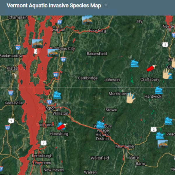
Aquatic Invasive Species Map
The AIS Map is a visual representation of aquatic invasive species population data, associated management actions, and spread prevention efforts statewide. This map can be used to filter based on the following layers: Public Access Greeter Programs, Vermont Invasive Patroller programs, AIS signage and public access information, AIS control efforts, and AIS status by waterbody. The AIS status by waterbody layer indicates known populations of high-profile AIS, and those waters where no AIS has been confirmed by DEC staff.
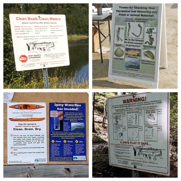
Aquatic Invasive Species Signage
Vermont DEC installs signs at public access areas that inform boaters of the steps they should take to avoid moving nuisance species users of any present infestations of invasive pests. Signs are updated annually as needed so that the public is kept current on new infestations and new threats. If you think there is an access in your area that needs signage, please contact Kim Jensen Kimberly.Jensen@vermont.gov.
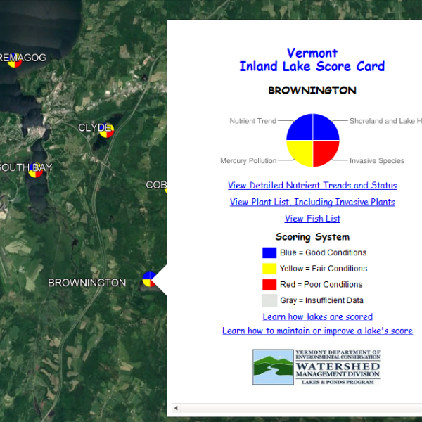
Lake Score Card
The Vermont Inland Lake Score Card is a user-friendly interface developed by the Vermont Lakes and Ponds Management and Protection Program (VLPP) to share available data on overall lake health with lake users. Using Google Earth, viewers can select from more than 800 lakes in the state and learn about four key aspects of lake health: nutrients, aquatic invasive species, shoreland and lake habitat, and mercury pollution. Plant surveys, including invasive species, are included in the Lake Score Card and are also available on the Vermont Integrated Watershed Information System (IWIS) under the site search tab.
Vermont Fish and Wildlife Access Areas
The Vermont Fish and Wildlife Map includes locations and additional information for public access areas accross the state. Aquatic Invasive Species signage at each of these locations provide information about which invasive species are present in the waterbody.