What's New
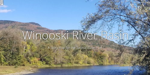
The Final 2023 Winooski Tactical Basin Plan (TBP) is ready to implement! All public comments received within the comment period were considered and addressed in the responsiveness summary included in the final plan, Appendix C. The TBP serves as the guidebook for water quality protection and restoration efforts in this watershed for the next five years. Moreover, the TBP provides the Phase III Implementation Plan update for the Lake Champlain Phosphorus Total Maximum Daily Load. A summary of the draft TBP is provided in an online StoryMap. A progress report on strategies from the 2018 Winooski TBP will be available in January 2024 as Appendix C of the Vermont Clean Water Initiative 2023 Performance Report.
Tactical Basin Planning Summary
The Winooski River watershed (Basin 8) covers approximately 1080 square miles, and accounts for 11.5 percent of Vermont’s land area. The main stem of the Winooski River flows 94 miles from Cabot to Colchester and enters Lake Champlain at an elevation 1,200 feet lower than where it originates. The watershed occupies major parts of Washington and Chittenden Counties and lesser parts of Lamoille, Orange, Caledonia, and Addison Counties. It includes fifty towns and is roughly 73% forest, 9% agriculture, 9% surface waters and wetland, 6% field and shrubland, and 3% developed area including roads.
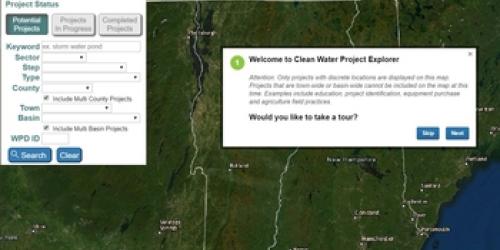
Five-year Tactical Basin Plans provide updates on current watershed conditions and identify water quality focused strategies to protect and restore the watershed’s surface waters. The central component of the Tactical Basin Plan is an implementation table summary with targeted strategies to protect high-quality waters and to address the water quality issues in the watershed. These strategies are developed in partnership with a variety of non-profit, Conservation District, Planning Commission, town, state, and federal partners (see an incomplete list of Winooski organizations below). Stemming from such strategies, more than 1200 potential or in progress water quality projects in the Winooski watershed are searchable in the VT Watershed Projects Database and the Clean Water Project Explorer map.
See below for additional information:
- Story Map
- Winooski Basin Existing Uses
- Color map of the Winooski River basin with major tributary watersheds highlighted
- Winooski River Basin Water Quality and Aquatic Habitat Assessment Report
- Water Quality Assessment Maps
- Final 2012 Basin 8 Water Quality Management Plan and Appendix (5/18/2012)
Basin Specific Reports
- Impact Assessment of the Barre Coal Tar Site on the Aquatic Biota of the Stevens Branch, Barre, VT
- Aquatic Life Use Attainment Assessment of Big Spruce Brook
- Aquatic Life Support Use Assessment of Centennial Brook
- Bioassessment of the Dog River
- Biological Assessment of the Macroinvertebrate and Fish Communities of Great Brook, Plainfield, VT
- Aquatic Life Use Support Attainment of a tributary of Joiner Brook
- Aquatic Life Use Support Attainment of the Little River below Waterbury Reservoir
- 2017 Upper Winooski Watershed Fisheries Summary
Additional Resources
Programs or Organizations with Specific Ties to the Winooski River Basin
- Lake Champlain Basin Program
- Association of Vermont Conservation Commissions
- Central Vermont Regional Planning Commission
- Chittenden County Regional Planning Commission
- Winooski Natural Resource Conservation District
- Friends of the Winooski
- Vermont League of Cities and Towns
- Friends of the Mad River
- Vermont Rivers Conservancy
- Trout Unlimited (Mad Dog Chapter)
- Trout Unlimited (Central Vermont Chapter)
- Vermont Land Trust
- Vermont Paddlers Club
- Huntington River Conservation Partnership
- Regional Stormwater Education Program
- Chittenden County Stream Team
DEC-produced Publications & Guidance
- Tactical Basin Planning
- TMDL Information web page
- Lake Champlain Phosphorus TMDL
- Map of Vermont’s 15 Major Drainage Basins
- Flow: the Watershed Management Division's Blog