AND CONNECTICUT RIVER DIRECT TRIBUTARIES
Including: Mill, Mill, Lulls, Hubbard, Spencer and Commissary Brooks, and portions of the
Connecticut River
What's New
Implementation of the 2023 Black and Ottauquechee Rivers Basin Plan is underway.
The Plan and the Story Map provides an overview of the Basin, describe the water quality and habitat conditions and lay out the strategies and actions recommended for implementation over the coming years.
The Tactical Basin Plan actions identified in the Plan will protect or improve rivers, lakes, and wetlands through cost-effective projects, including floodplain restorations, dam removals and 15 other types of projects. The 57 priority strategies focus on improving water quality and aquatic habitat in all land use sectors including agriculture, developed lands, wastewater and natural resources. Additionally, this Plan offers strategies to address climate change adaptation and social equity concerns.
Almost 600 projects are identified in the Watershed Projects Database. Funding is available to implement these projects through state and federal projects. The participation of willing landowners across the Basin is needed to allow these projects to be implemented.
Landowners and others interested in participating can contact:
Marie Levesque Caduto, Watershed Coordinator
Vermont ANR / Department of Environmental Conservation
100 Mineral Street, Suite 303
Springfield, VT 05156-3168
Phone: 802-490-6142
Email: Marie.Caduto@vermont.gov
Two public meetings were held to discuss the DRAFT Water Quality Plan in May 2023 hosted by State and regional planners. Recordings of these meetings can be viewed.
May 22, 2023
- Woodstock, VT meeting:
- Watch the Meeting Recording
May 23, 2023
- Ascutney, VT meeting:
- Watch the Meeting Recording
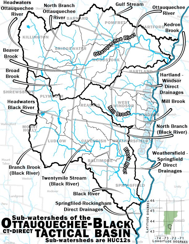
The Basin
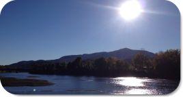
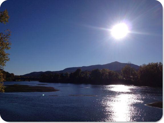
Basin 10 consists of two major watersheds in southeastern Vermont - the Ottauquechee River watershed and the Black River watershed. Both rivers flow from the central Green Mountain range with Killington Peak in the northwest, Ludlow or Okemo Mountain in the southwest boundary and Mount Ascutney to the east along the Connecticut River.
Basin 10 also includes about 33 miles of the mainstem of the Connecticut River and the streams that flow directly into it from White River Junction down to the mouth of the Williams River in Rockingham. [Map Description automatically generated] Among these tributaries are the two Mill Brooks that run on the north and south sides of Ascutney Mountain, Lulls, Hubbard, Spencer, and Commissary Brooks.
The Ottauquechee River has a mainstem length of 38 miles and drains an area of 223 square miles. From Killington Peak the river drops almost 3900 feet in elevation down to the Connecticut River in Hartland.
The Black River has a mainstem length of 40 miles and drains an area of 202 square miles. It is formed at the outlet of Black Pond in the town of Plymouth and drops 3040 feet in elevation from the top of Ludlow Mountain (Okemo) to Hoyts Landing in Springfield.
There are 32 lakes and ponds in the Basin that are 10 acres or larger covering approximately 1,877 acres. The North Springfield Reservoir, North Hartland Reservoir, Echo Lake, Lake Rescue, Lake Ninevah and Woodward Reservoir are the largest bodies of water in the Basin, each being over 100 acres in size.
Protection and restoration projects are underway and many have been identified for implementation. This planning process hopes to identify other projects needing to be done and gain support and participation in implementing them.
Projects in the Basin can be found in the Clean Water Project Explorer an interactive mapping application that displays clean water project information, including funding, results, and nutrient reductions from the State of Vermont's clean water tracking database. Users can search clean water project data from six state agencies and download individual project reports.
Projects can also be found in the Watershed Projects Database, a list of all projects searchable by Basin.
Black and Ottauquechee Rivers Tactical Basin Plan
- 2018 Tactical Basin Plan for Basin 10 (6/13/2018)
- 2012 Final Basin 10 Water Quality Management Plan and Appendix
For more information or to become involved in the basin planning process contact:
Additional Resources
- B10 Existing Use Tables 2023.pdf
- Watershed Assessment Reports
- Black River Corridor Plan 2009
- Black River Corridor Plan Addendum - Patch and Buffalo Brooks 2010
- Ottauquechee River Corridor Plan 2013
- Roaring Brook Phase 1 and 2 2006
- Municipal Stormwater Infrastructure Maps, Stormwater Master Plans, and Illicit Discharge Detection and Elimination (IDDE) Reports