
What's New
The Final 2023 Lake Memphremagog, Tomifobia and Coaticook Tactical Basin plan is ready for Action! All public comments received within the comment period were considered and addressed in the responsiveness summary included in the final plan in Appendix B. The Tactical Basin Plan serves as the guidebook for water quality protection and restoration efforts in this basin for the next five years. The plan provides updates on water quality challenges in the Lake Memphremagog watershed, progress that has been made over the last five years improving waters for fishing, swimming, and boating, and includes targeted strategies on how we can improve these efforts over the next five years. A summary of the draft plan is covered in a StoryMap that can be viewed online and in the following summary document. The status and updates on the strategies from the 2017 plan is available at this link Basin 17 report card.
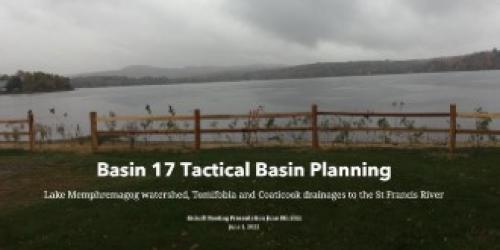
Basin 17 includes the Vermont portions of the St. Francis River Watershed encompassing a total of 589 square miles between the Lake Memphremagog drainage and the Tomifobia and Coaticook River watersheds. The Vermont portion of this basin includes the Black, Barton and Clyde Rivers and many lakes and ponds, including Great and Little Hosmer Lakes, Lake Parker, Shadow Lake, Crystal Lake, Lake Willoughby, lake Salem, Island Pond, Great and Little Averill Ponds, Norton Pond, Holland Pond and Seymour Lake.
Lake Memphremagog Phosphorus Total Maximum Daily Load (TMDL)
Lake Memphremagog is shared with the province of Quebec, with a majority of the lake in Quebec, but a majority of the watershed in Vermont. Phosphorus levels in Lake Memphremagog are above the Vermont State Water Quality Standards. Excess phosphorus that runs off the land into the lake causes occasional cyanobacteria blooms and nuisance plant and algae growth, which limit the recreational use of the lake. The Total Maximum Daily Load or TMDL for Lake Memphremagog, developed using lake and watershed models and approved by the Environmental Protection Agency (EPA) in September 2017, calls for a 29% reduction in phosphorus inputs.
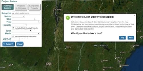
Learn about projects in your area, and view more than 350 specific actions for the Lake Memphremagog, Tomifobia and Coaticook Basin through the Watershed Projects Database. Select "Basin 17-Lake Memphremagog" and click on the “Search” button.
Visit the Restoring Lake Memphremagog webpage to learn more about the Lake Memphremagog TMDL and work of the Quebec Vermont Steering Committee on Lake Memphremagog.
Contact Ben Copans at 802-490-6413 with any questions about the TMDL or tactical basin plan.
Resources
- Lake Memphremagog Phosphorus Total Maximum Daily Load (TMDL)
- Lake Memphremagog TMDL Modeling Documentation
- Lake Memphremagog, Coaticook and Tomifobia 2017 Tactical Basin Plan
- Lake Memphremagog, Coaticook and Tomifobia Existing Uses
Additional Resources
- Review of Basin 17 Stream Geomorphic Assessments & Sediment Stressed Conditions in Stearns Brook, 2022.
- Lake Memphremagog Basin Assessment Report 2015
- Tactical Basin Planning
- Map of Vermont's 15 Major Drainage Basins
- Lake Memphremagog Watershed Water Quality Assessment Report (March 2006))
- Memphremagog Conservation Inc. (MCI)
- Northeastern Vermont Development Association (NVDA)
- Northwoods Stewardship Center
- 2008 Quebec-Vermont report on The Water quality of Lake Memphremagog
- Seymour Lakes Association
- Echo Lake Protective Association
- Memphremagog Watershed Association
- Orleans County Natural Resources Conservation District
- Proposed Watershed Projects for the Basin 17 Tactical Plan