What's New
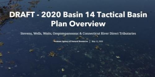
The Final 2020 Basin 14 Tactical Basin Plan is ready for action! All public comments recieved within the comment period were considered and addressed in the responsiveness summary included in the final plan in Appendix E.
On June 2, 2020, the Vermont Department of Environmental Conservation (DEC) Basin 14 Watershed Planner hosted a virtual meeting to gather feedback on the plan. The public was encouraged to attend the online meeting, hear a presentation, and offer comments and suggestions. The public meeting is available for viewing below.
The meeting was presented in partnership with the Two Rivers Ottauquechee Regional Planning Commission, Northeast Vermont Development Association, Central Vermont Planning Commission, Caledonia County Natural Resource Conservation District, and the White River Natural Resources Conservation District.
A paper copy of the plan can be requested from Keith Fritschie by email or phone: keith.fritschie@vermont.gov (802) 490-6176.
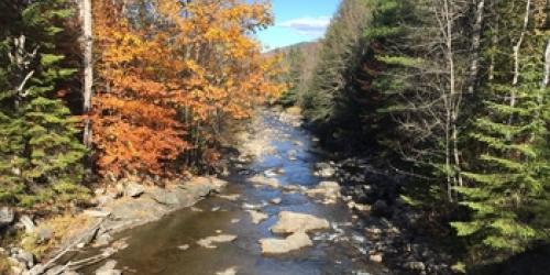
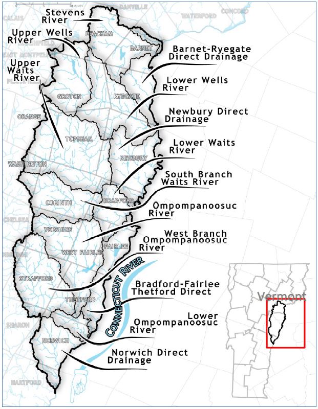 The 2020 Basin 14 Tactical Basin Plan (TBP) covers 20 towns in the three counties of Orange, Caledonia, and Windsor, from Peacham to Hartford. Basin 14 includes the Stevens, Wells, Waits and Ompompanoosuc Rivers, Peacham bog, Lake Groton, Harveys Lake, and Lake Morey, home to the nation’s longest outdoor ice-skating track.
The plan provides an assessment of the health of the basin and identifies 56 water quality strategies related to agriculture, developed lands, wastewater, and natural resources – forests, lakes, rivers, and wetlands. The plan also includes information about how landowners, watershed organizations, and communities can access funding and technical assistance to help protect and restore water resources.
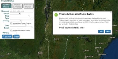
Progress on the implementation of the 2015 plan is ongoing and is reported in Appendix A of the DRAFT 2020 Basin 14 TBP. Projects from assessments and inventories conducted in Basin 14 have been added to the Watershed Projects Database and can be accessed by the public. New projects can be added to the database by contacting your Watershed Planner.
Existing Uses in Basin 14
Contact your Watershed Planner to suggest additional waters for Existing Uses.
Keith Fritschie
Vermont Department of Environmental Conservation
Water Investment Division
1 National Life Drive, Main 2
Montpelier, VT 05620-3522
Phone: (802) 490-6176
Email: keith.fritschie@vermont.gov
2015 Stevens, Wells, Waits and Ompompanoosuc Tactical Basin Plan
The 2015 TBP was finalized on August 27, 2015 for use by Agencies and partner organizations to protect, maintain, enhance, and restore surface waters.
2015 Stevens, Wells, Waits and Ompompanoosuc Tactical Basin Plan
2009 Basin 14 Water Quality Management Plan.
- Basin 14 Water Quality Management Plan (PDF, 2.5 MB).
- Basin 14 Appendix (PDF, 616 KB).
- Basin 14 Report Card (PDF, 115 KB)