-
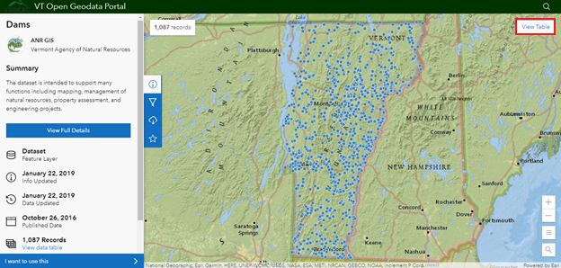
Navigate to VT Open Geodata Portal. This page can used to explore the location of dams. Hover over points to see the names of each dam.
-
To view the table containing data on each dam, select [View Table] in the top right corner of the map.
-
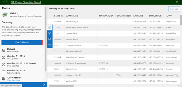
To download the data in this table, select [View Full Details] in the column on the left. This will bring you to a new page.
-
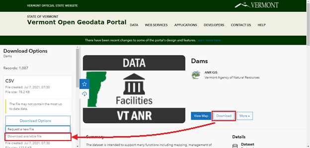
Next, select [Download]. This will open a column on the left with options for different file types (CSV, KML, Shapefile, GeoJSON).
-
Choose your preferred file type and select [Download Options] and [Download available file].