The DSP is responsible for the management and operation of 14 dams owned by the Vermont Department of Environmental Conservation. This includes the three Winooski River flood-control dams: Waterbury, Wrightsville, and East-Barre.
High Hazard Potential Classification
Significant Hazard Potential Classification
Low Hazard Potential Classification
High Hazard Potential Classification:
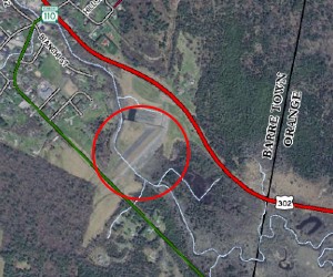
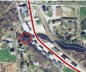
Town: Barre Town VT
Stream: Jail branch
Location: 44.155, -72.4443
Hazard Potential Classification: High
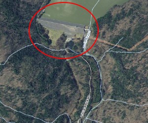
Background: The East Barre Dam was constructed by the Civilian Conservation Corps under the supervision of the U.S. Army and completed in the fall of 1935 for the purposes of flood control. Additional modifications to the East Barre Dam were performed between 1959 and 1960.
Current Purpose: Flood Control
Dam Type: Earth Embankment 
Dam Height: 65 feet
Dam length: 1,460 feet
Drainage Area: 39 square miles
Maximum Storage: 23,550 acre-feet
Emergency Action Plan: Yes
Project: No projects at this time.
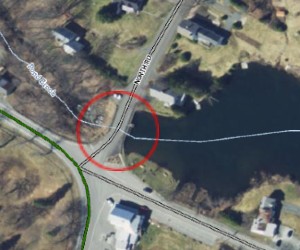
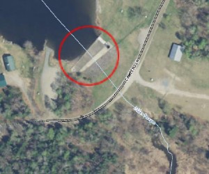
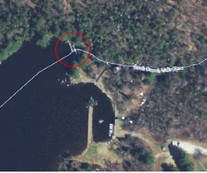
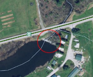
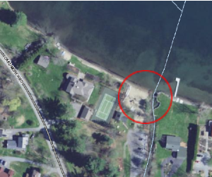
Town: Barnard, VT
Stream: Pond Brook
Location: 43.7288, -72.6186
Hazard Potential Classification: High Hazard
Background: The Silver Lake Dam was constructed in 1968. These walls are placed against and doweled to existing concrete and masonry walls constructed as early as 1806. This embankment also serves as the foundation for a town highway, the North Road, running along the dam's crest. The embankment was reconstructed in 1984.
Current Purpose: Recreation
Dam Type: Earth-fill dam with concrete core wall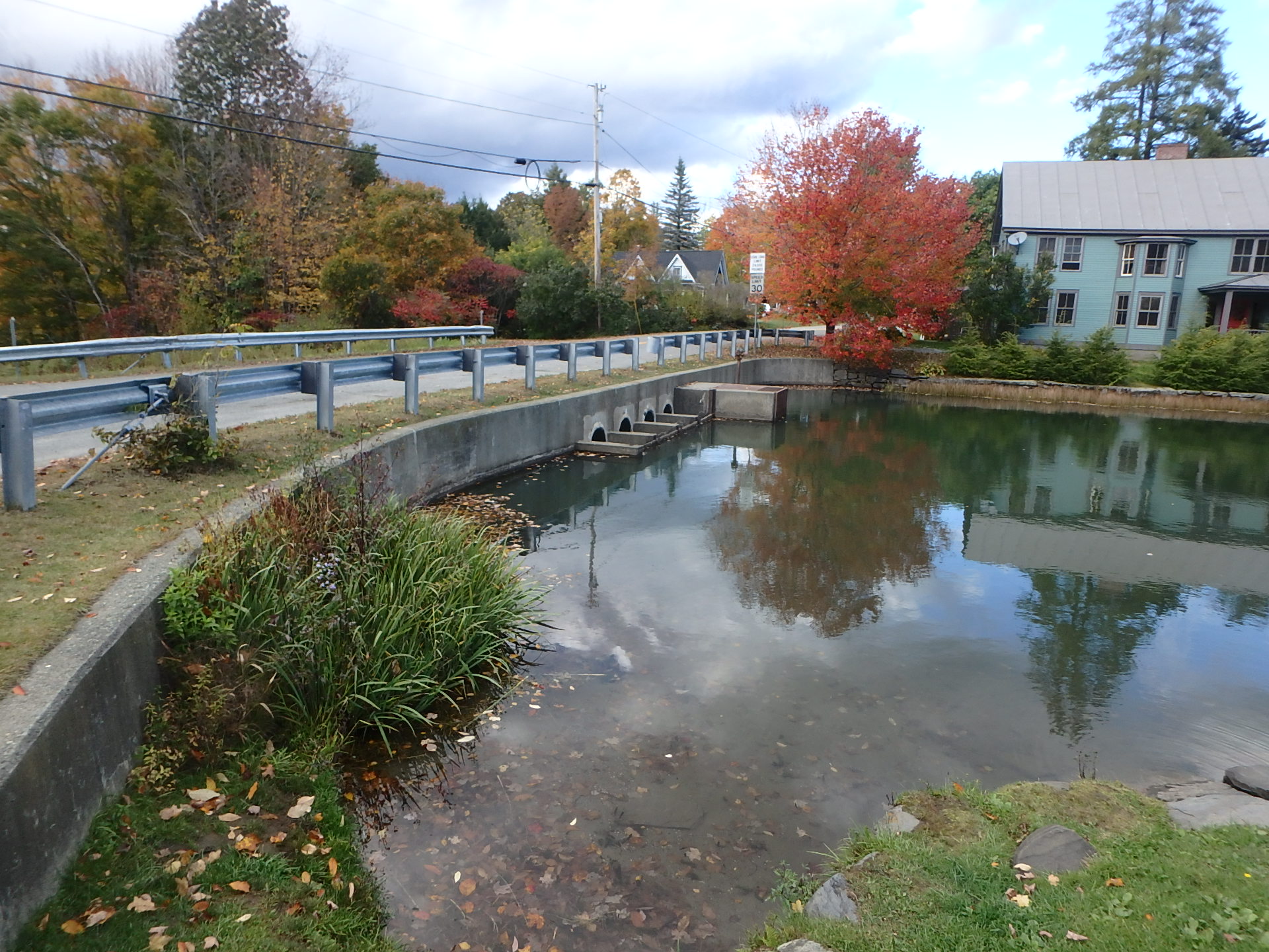
Dam Height: 30 feet
Dam Length: 100 feet
Drainage Area: 1.7 square miles
Maximum Storage: 1,710 acre-feet
Emergency Action Plan: Yes
Project: A comprehensive assessment of the dam is underway and due for completion in Summer 2024.
Town: Waterbury, VT
Stream: Little River
Location: 44.3813, -72.7677
Hazard potential Classification: High
Background: The Waterbury Dam was constructed in 1938 by the Civilian Conservation Corps (CCC) under the supervision of the Corps of Engineers (USACE) as part of the Winooski Flood Control Projects.
Current Purpose: Flood Control, Hydroelectric, Recreation
Dam Types: Earth Embankment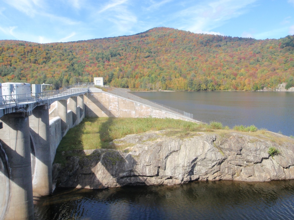
Dam Height: 187 feet.
Dam Length: 2,130 feet
Drainage Area: 109 square miles
Maximum Storage: 88,000 acre-feet
Emergency Action Plan: Yes
Project: Waterbury Dam Spillway Project (2022-2029) - Currently in Design/Field Exploration
Town: Middlesex, VT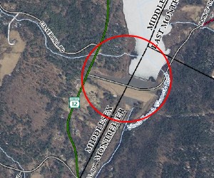
Stream: North Branch Winooski River
Location: 44.3107, -72.5744
Hazard Potential Classification: High Hazard
Background: The Wrightsville Dam was constructed as part of the Winooski Flood Control Projects in 1935 by the Civilian Conservation Corps (CCC) under the supervision of the Corps of Engineers (USACE). It was modified to its current configuration in the early 1980s, including a hydropower station.
Current Purpose: Flood Control, Hydroelectric, Recreation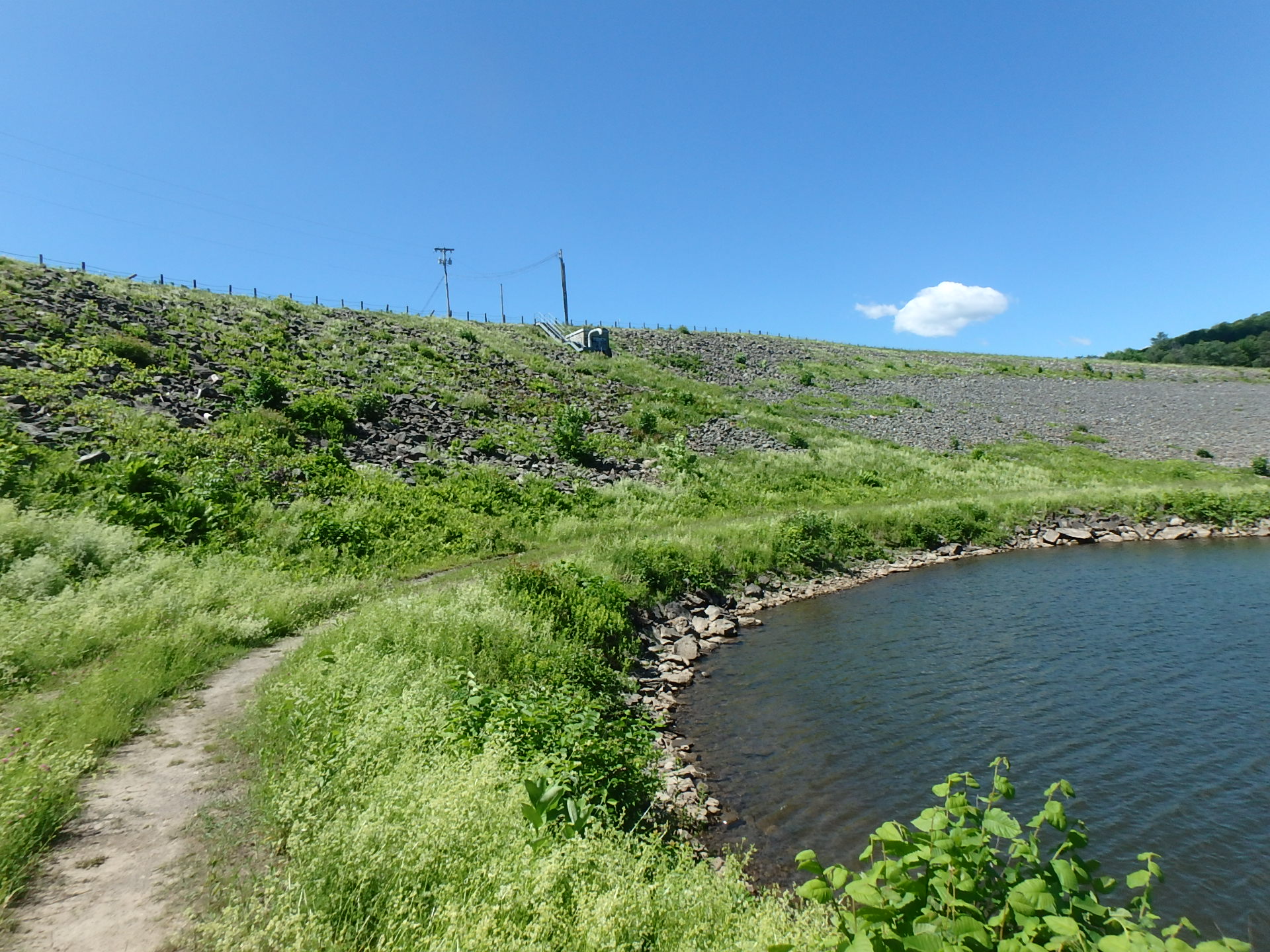
Dam Type: Earth Embankment
Dam Height: 115 feet
Dam length: 1,525 feet
Drainage Area: 68 square miles
Maximum Storage: 36,000 miles
Emergency Action Plan: Yes
Project: Auxiliary Spillway improvements were completed in fall 2023. Currently working with USACE to develop an agreement to perform a study to evaluate improving the operational flexibility of the dam during flooding events. Pre-programming a project to perform maintenance to the outlet tunnels.
Significant Potential Hazard Classification:
Town: Barton, VT
Location: 44.747, -72.1763
Stream: Barton River
Hazard Potential Classification: Significant Hazard
Background: The Crystal Lake Dam was constructed in the early 1800s to provide mill power and was reconstructed in 1966.
Current Purpose: Recreation
Dam Type: Concrete and Stone Masonry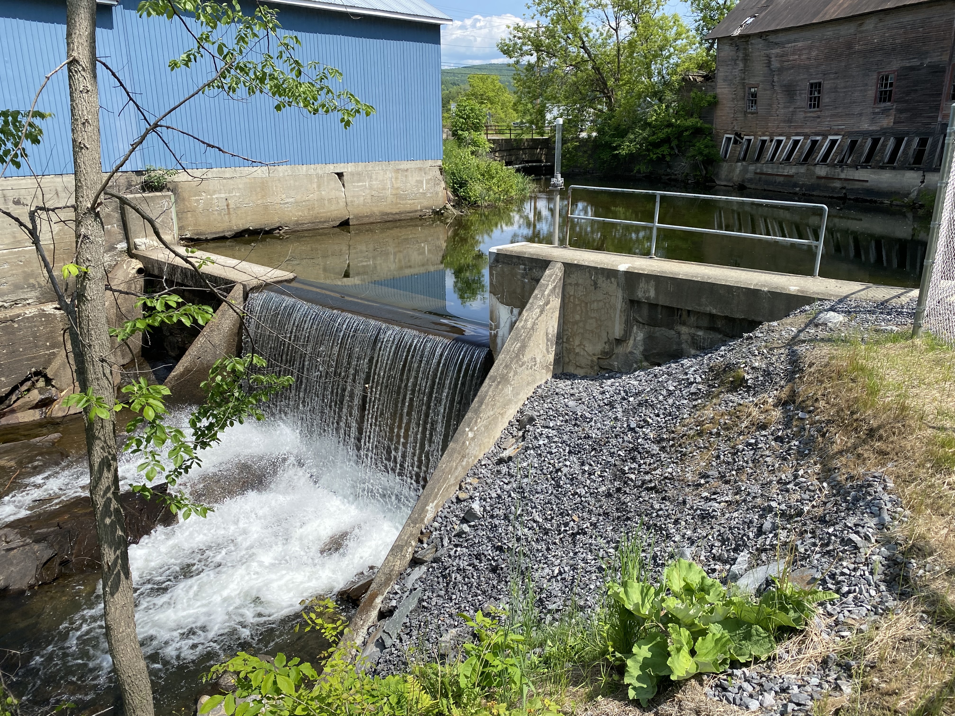
Dam Height: 17 feet
Dam Length: 65 feet
Drainage Area: 22.58 square miles
Maximum Storage: 6,740 acre-feet
Emergency Action Plan: Yes
Project: Pre-programming of a comprehensive assessment of the dam.
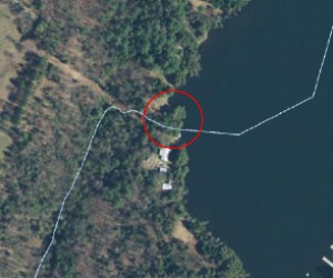
Town: Craftsbury, VT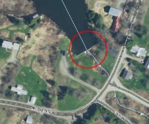
Stream: Black River Tributary
Location: 44.6665, -72.3758
Hazard Potential Classification: Low hazard
Background: The Little Hosmer Pond Dam was constructed in 1969.
Current Purpose: Recreation
Dam Type: Earth-fill concrete gravity dam
Dam Height: 7 feet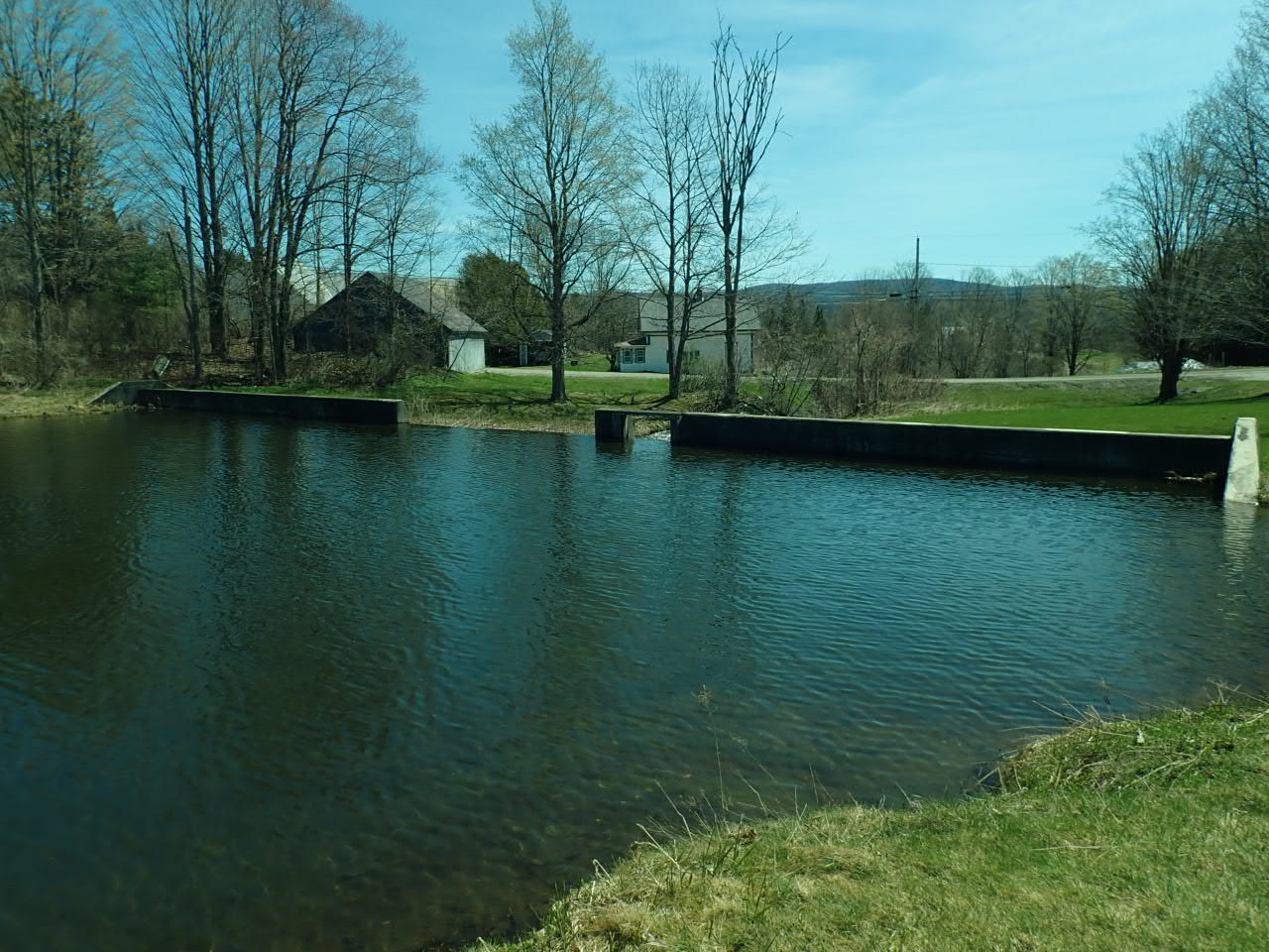
Dam Length: 200 feet
Drainage Area: 2.8 square miles
Maximum Storage: 825 acre-feet
Emergency Action Plan: Not required
Project: Comprehensive assessment underway with planned completion date in 2025.
Town: Concord, VT
Stream: Miles Stream
Location: 44.4463, -71.7972
Hazard Potential Classification: Significant Hazard
Background: The Miles Pond Dam was constructed in 1969 by the Department of Water Resources and replaced an existing milldam, which had been at the site since at least 1900. The Dam was reconstructed in 1993 to include a widened and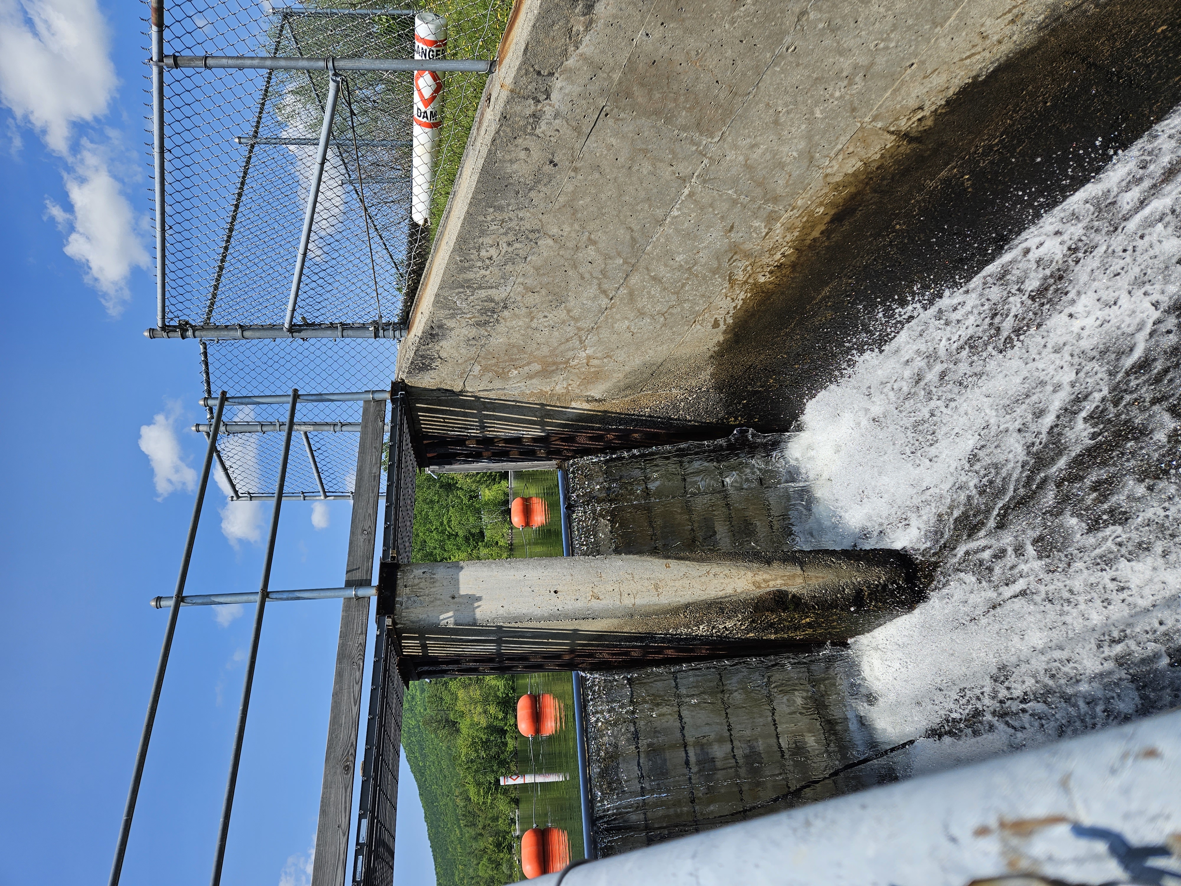 stabilized emergency spillway.
Current Purpose: Recreation
Dam Type: Earth-fill dam with concrete core wall
Dam Height: 19 feet
Dam Length: 250 feet
Drainage Area: 6.54 square miles
Maximum Storage: 2,200 acre-feet
Emergency Action Plan: No (DSP working to develop one)
Project: No projects at this time.
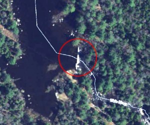
Town: Groton, VT
Stream: South Branch Wells River
Location: 44.2283, -72.3056
Hazard Potential Classification: Significant Hazard
Background: The Noyes Pond Dam was originally built in 1934, and parts of the dam were reconstructed in 1989.
Current Purpose: Recreation
Dam Type: Earth-fill, concrete dam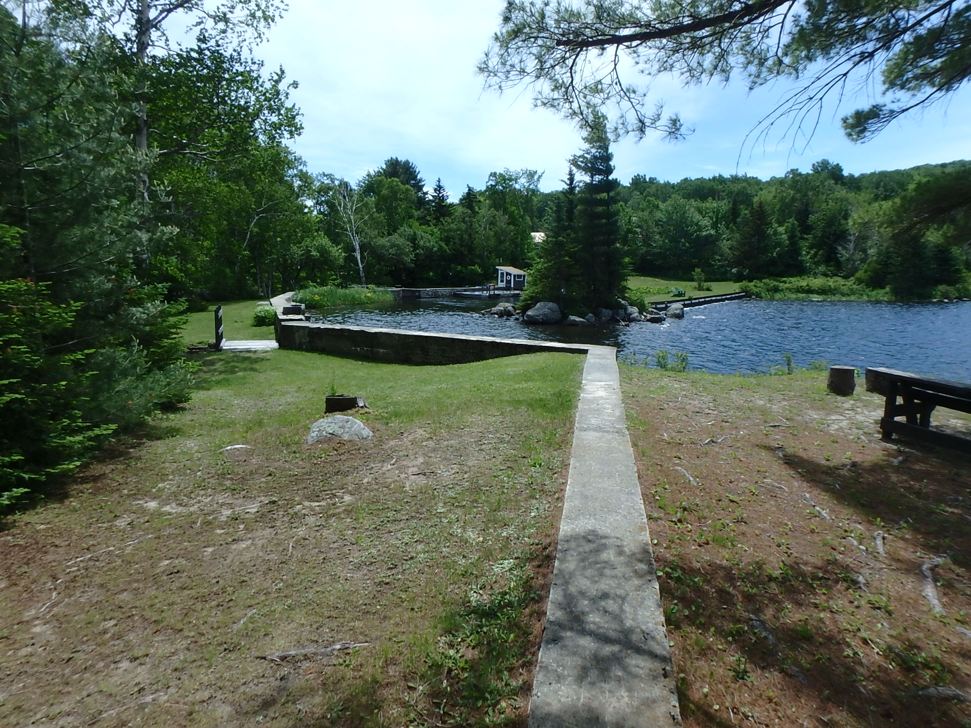
Dam Height: 17 feet
Dam Length: 453 feet
Drainage Area: 3.76 square miles
Maximum Storage: 350 acre-feet
Emergency Action Plan: Yes
Project: Comprehensive assessment completed in 2023. Pre-programming for the dam rehabilitation design phase is underway.
Low Hazard Potential Classification
Town: Craftsbury, VT
Stream: Black River tributary
Location: 44.6832, -72.3676
Hazard Potential Classification: Low Hazard
Background: The Great Hosmer Pond Dam was originally built in the early 1800’s. In 2012, parts of the dam were reconstructed.
Current Purpose: Recreation
Dam Type: Concrete Gravity Dam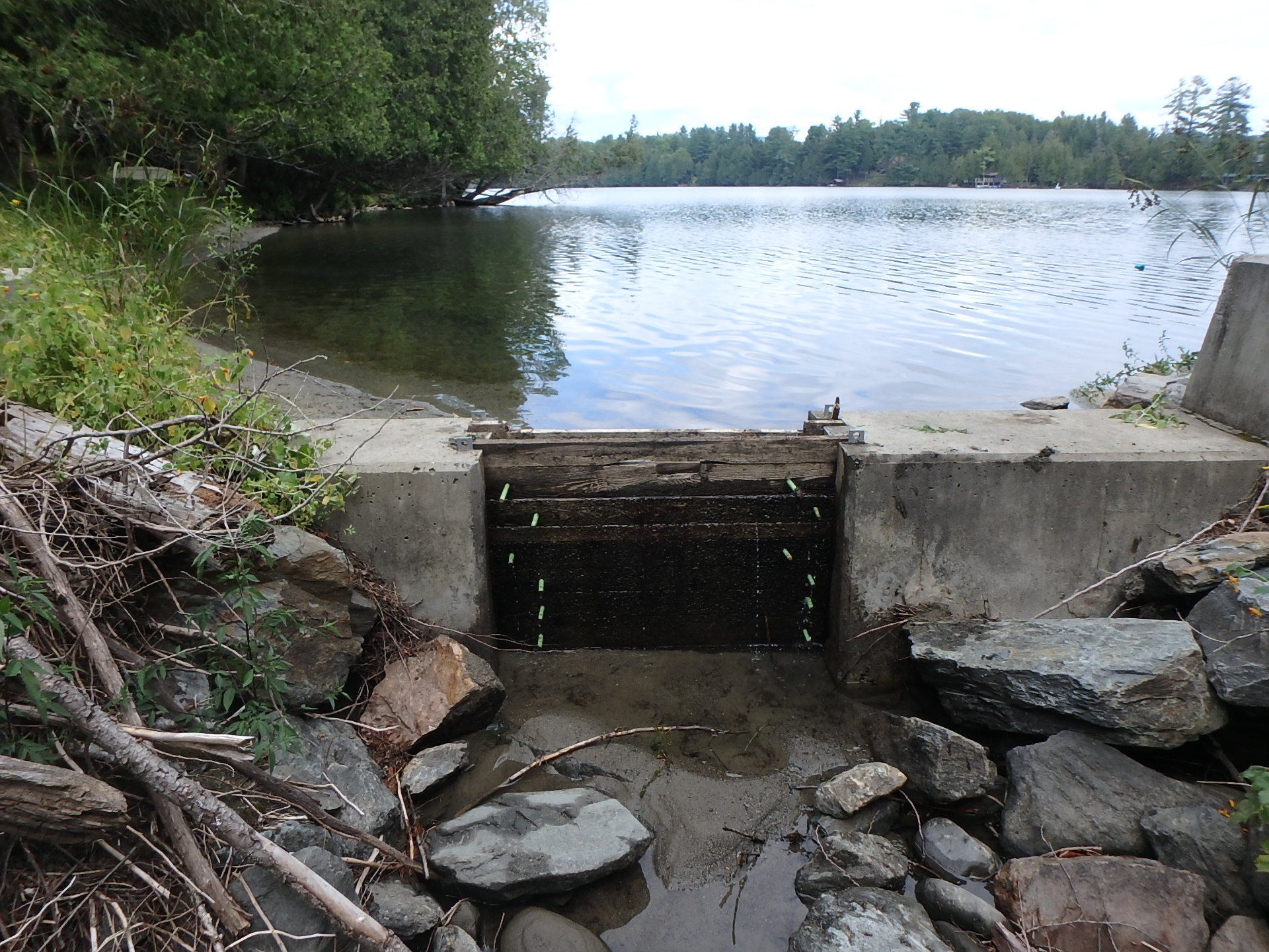
Dam Height: 6 feet
Dam Length: 34 feet
Drainage Area: 1.25 square miles
Maximum Storage: 380 acre-feet
Emergency Action Plan: Not required
Project: No projects at this time.
Town: Castleton, VT
Stream: Castleton River tributary
Location: 43.6052, -73.2333
Hazard Potential Classification: Low Hazard
Background: The Lake Bomoseen Dam was constructed on an unnamed tributary of the Castleton River around 1850 for the purpose of mill power. Records of dam reconstruction indicate major work was done in 1903, 1913, 1953, 1979, 1986, and 1994. The State acquired the site in 1969. Repairs to the concrete were conducted in 2016.
Current Purpose: Recreation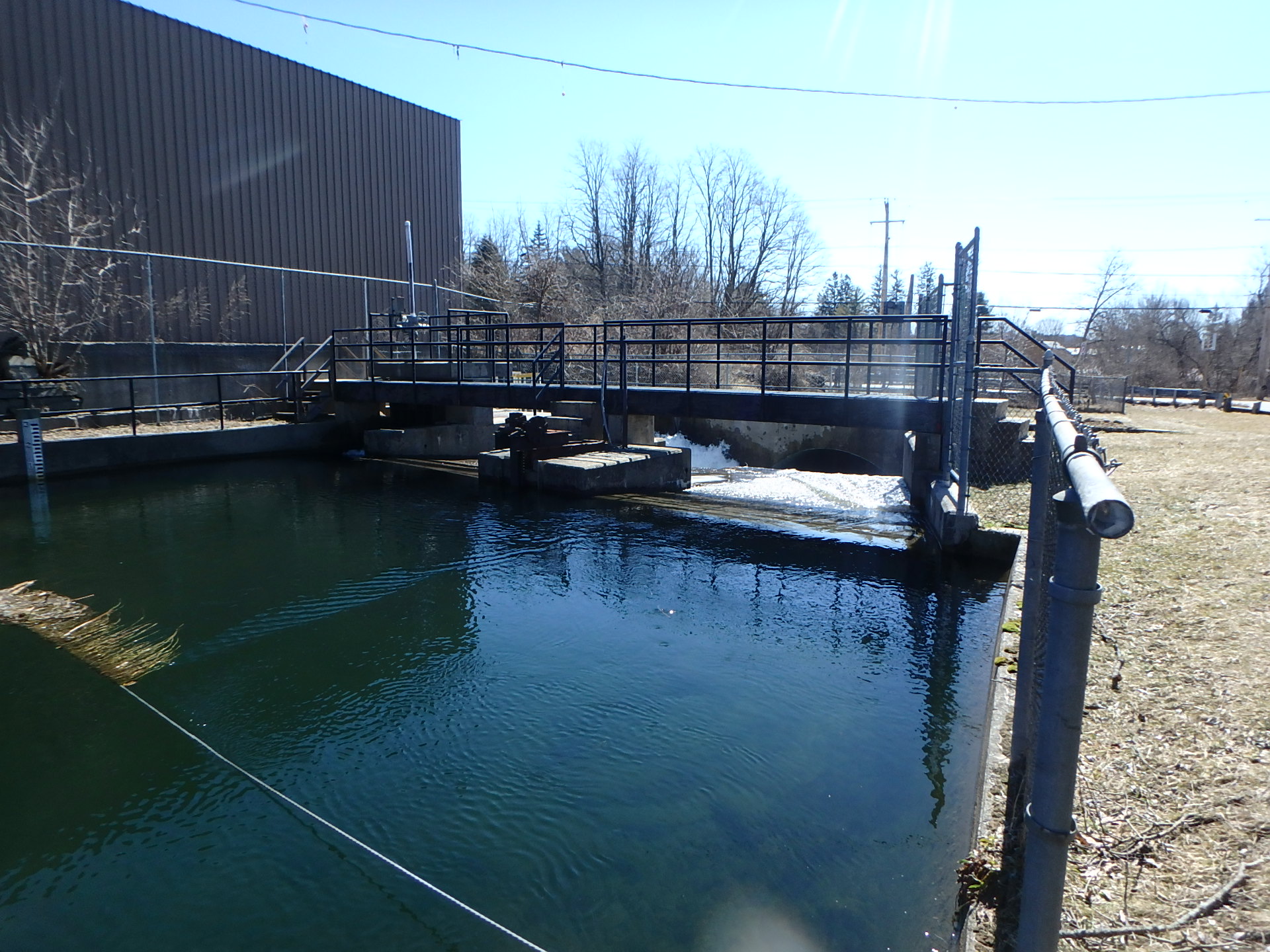
Dam Type: Concrete and Stone Masonry
Dam Height: 11 feet
Dam Length: 45 feet
Drainage Area: 37 square miles
Maximum Storage: 10,310 acre-feet
Emergency Action Plan: Not required
Dam Operation: The State contracts with a Dam Operator who performs daily operations and maintenance of the dam. Operations are performed in accordance with Surface Water Rules; that is, the levels are generally maintained near gage zero, favoring plus 3 inches in the summer months and favoring minus three inches in the winter months. In addition, the dam operator monitors the dam during flood events, observes and records daily water levels, and provides that information to the State. If you have any questions or concerns regarding the dam or operations, please contact Ben Green at Benjamin.green@vermont.gov or 802-622-4093.
Project: No projects at this time.
Town: Franklin, VT
Stream: Pike River tributary
Location: 44.9897, -72.8482
Hazard Potential Classification: Low Hazard
Background: In 1969, the State of Vermont bought the property containing the Lake Carmi Dam and part of the Mill Pond, formerly known as LaBelle’s Mill, from Lucy and Shirley Bruso. In 1970, the dam was rebuilt, and Mill Pond (Lake Carmi) was restored for recreational use.
Current Purpose: Recreation
Dam Type: Earth-fill Concrete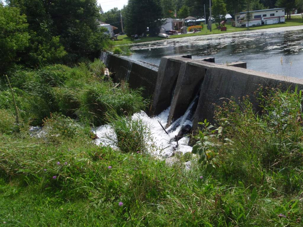
Dam Height: 9 feet
Dam Length: 160 feet
Drainage Area: 12.05 square miles
Maximum Storage: 6,200 acre-feet
Emergency Action Plan: Not required
Project: Dam rehabilitation to begin during the 2024 construction season.
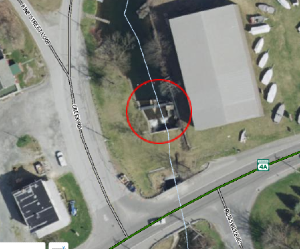
Town: Groton, VT
Stream: Ricker Pond tributary
Location: 44.2508, -72.2537
Hazard Potential Classification: Low Hazard
Background: The dam was constructed in 1968 in its current configuration. The stoplog bays and a 41-foot section of dam to the right of the principal spillway were rehabilitated in 2011.
Current Purpose: Recreation
Dam Type: Concrete gravity dam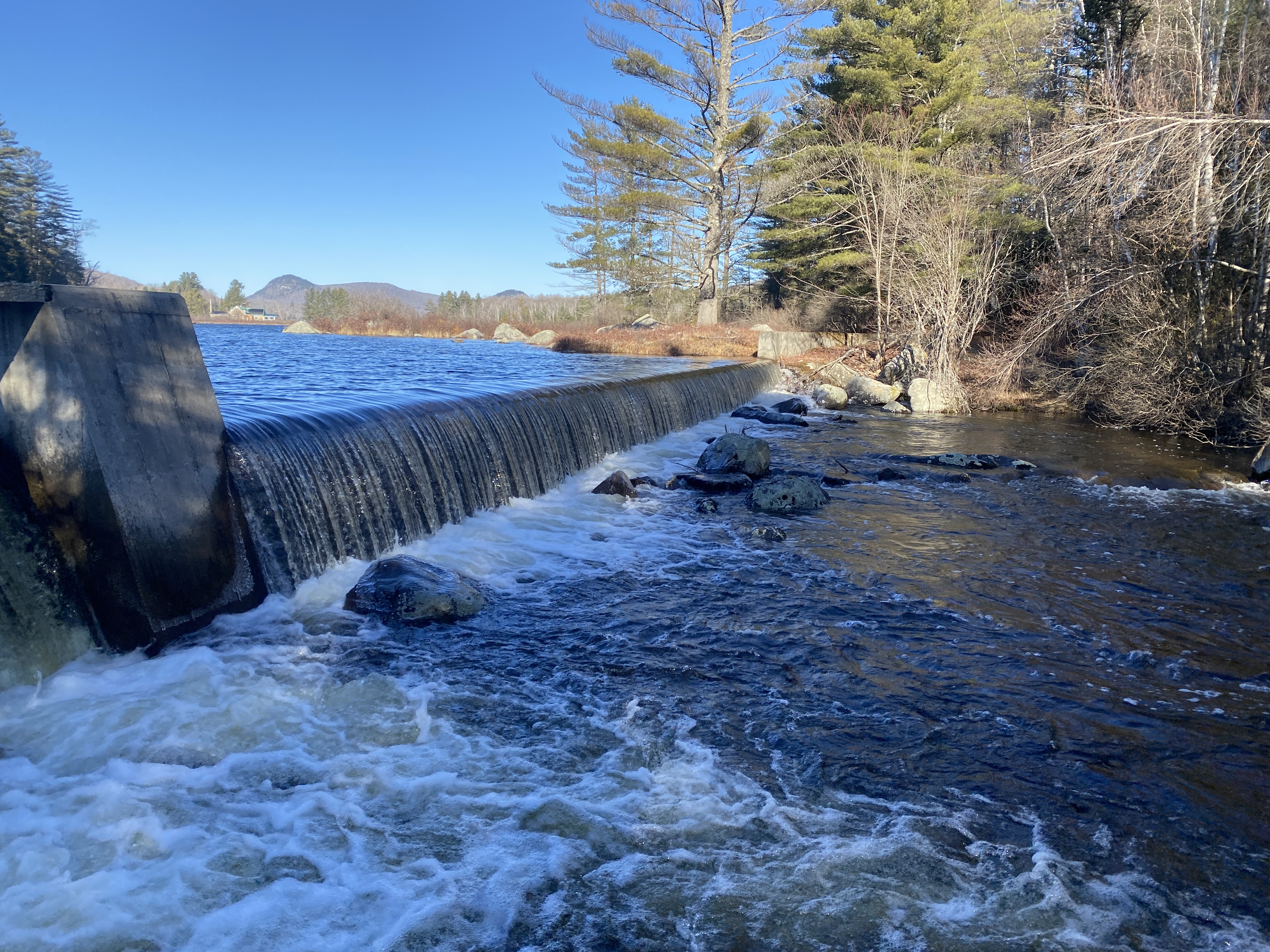
Dam Height: 13 feet
Dam Length: 598 feet
Drainage Area: 18.75 square miles
Maximum Storage: 5,148 acre-feet
Emergency Action Plan: Not required
Project: No projects at this time.
Town: Fairlee, VT
Stream: Connecticut River tributary
Location: 43.9106, -72.1576
Hazard Potential Classification: Low Hazard
Background: The Lake Morey Dam was constructed in 1897 and was reconstructed in 1949.
Current Purpose: Recreation
Dam Type: Concrete gravity dam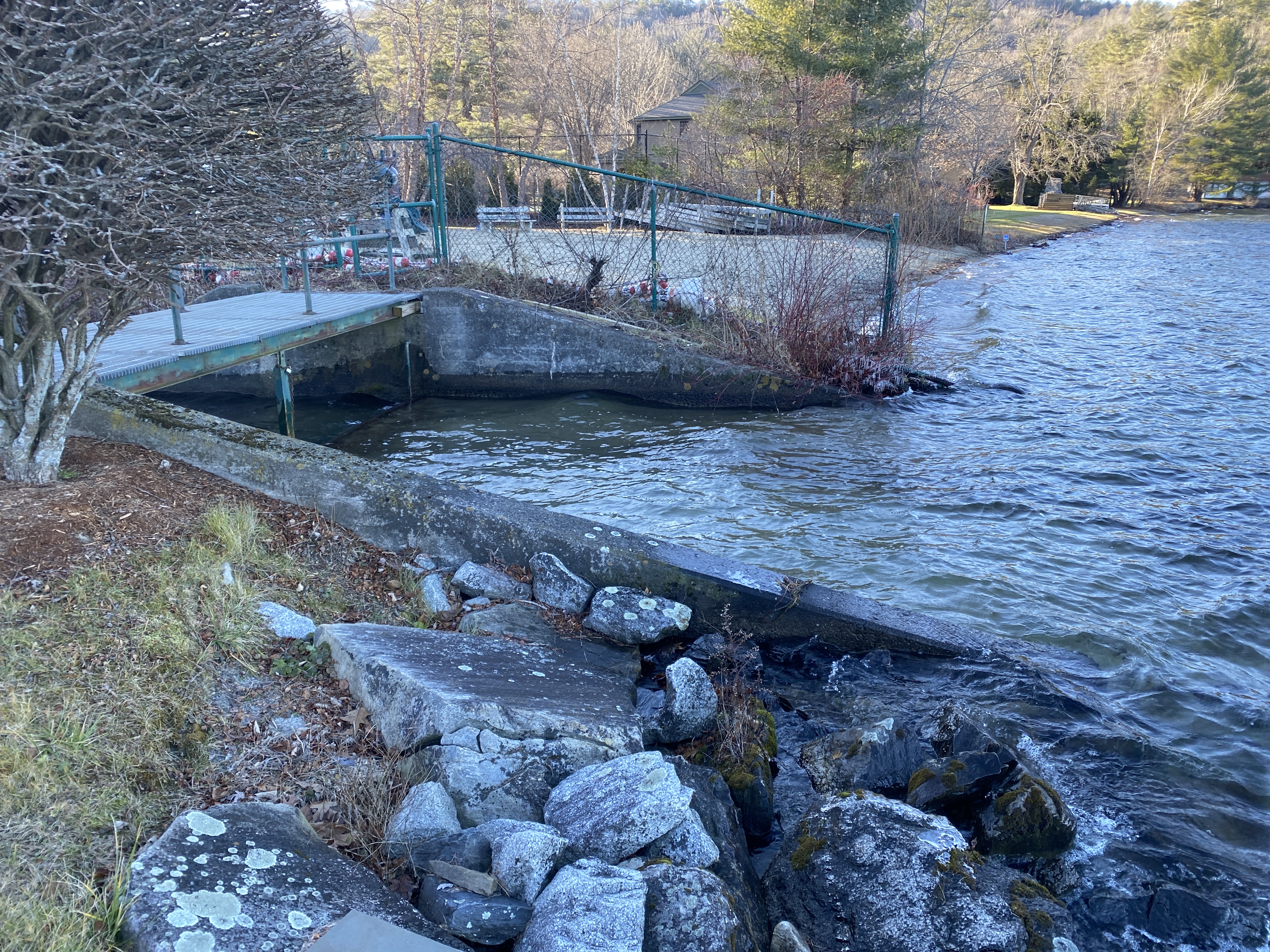
Dam Height: 5 feet
Dam Length: 20 feet
Drainage Area: 7.26 square miles
Maximum Storage: 2,150 acre-feet
Emergency Action Plan: Not required
Project: Dam site under legal review regarding dam ownership.
Town: Wolcott, VT
Stream: Wolcott Pond Brook
Location: 44.5682, -72.4266
Hazard Class: Low Hazard
Background: Wolcott Pond Dam was constructed in 1968. In 2015, the outlet pipe was replaced, and trees were cleared from the dam.
Current Purpose: Recreation
Dam Type: Earth embankment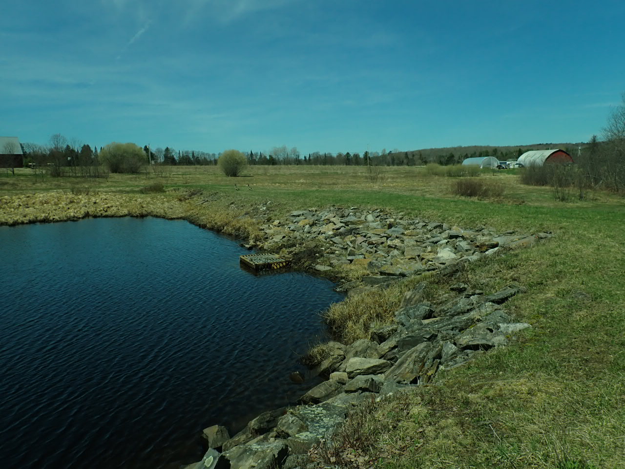
Dam Height: 9 feet
Dam Length: 270 feet
Drainage Area: 1.44 square miles
Maximum Storage: 550 acre-miles
Emergency Action Plan: Not required
Project: No Projects at this time.