What’s New
The Final 2024 Northern Lake Champlain Tactical Basin Plan (TBP) is ready to implement! All public comments received within the comment period were considered and addressed in the responsiveness summary included in the final plan, Appendix C. The TBP serves as the guidebook for water quality protection and restoration efforts in this watershed for the next five years. Moreover, the TBP provides the Phase 3 Implementation Plan update for the Lake Champlain Phosphorus Total Maximum Daily Load. A summary of the draft TBP is provided in an online StoryMap. A progress report on strategies from the 2020 Northern Lake Champlain TBP will be available in January 2024 as an Appendix of the Vermont Clean Water Initiative 2024 Performance Report.
2024 Public Meetings and Comment Period – September 25 to October 31, 2024
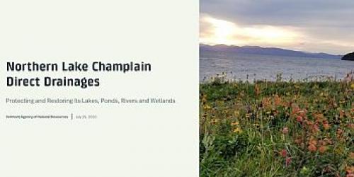
The Water Investment Division has developed the 5-year update of the Northern Lake Champlain Direct Drainages Tactical Basin Plan, including an updated list of actions from the 2020 plan. Find the Draft Plan Here: Northern Lake Champlain Direct Drainages Draft Tactical Basin Plan.
The final draft of the plan was made available for review and public comment from September 25 to October 31, 2024.
Both virtual and in-person meetings to present the draft plan were held in October as follows:
October 1, 2024 from 11:00 am to 12:00 pm in Winooski hosted by the Chittenden County Regional Planning Commission’s Clean Water Advisory Committee at 110 West Canal Street, Suite 202. This ZOOM link was used to join the virtual meeting: https://us02web.zoom.us/j/86481563112;
October 17, 2024 from 6:00 to 7:30 pm in Essex Junction at the Agency of Natural Resources District office in the Fish and Wildlife Conference Room on 111 West Street. This TEAMs link was used to join the virtual meeting: https://tinyurl.com/3s3xub8u.
Please contact Karen Bates, Watershed Planner at Karen.Bates@Vermont.gov or (802) 490-6144 with any questions.

2020 Northern Lake Champlain Direct Drainages Tactical Basin Plan
The 2020 Northern Lake Champlain Direct Drainages Tactical Basin Plan (summarized in a Story Map found at this link: https://arcg.is/r10Se) is a five-year water quality management plan. The Plan provides an overall assessment of the health of the Basin and defines on-going and future actions and strategies to address high-priority stressors such as encroachment, stream channel erosion, land erosion, and pathogens. The plan also includes recommendations for protection of high-quality water resources in the basin.
State and federal resource agencies, watershed partner organizations, regional planning commissions and municipalities assist the Agency of Natural Resources with the development and implementation of the plan.
The Plan also includes the Phase II content (Chapter 3) for the Lake Champlain Phosphorus Total Maximum Daily Load (TMDL), including setting targets for phosphorus loading from the basin to Lake Champlain. The Phase II content includes high-resolution phosphorus load modeling and projected phosphorus reductions for smaller sub-watershed as well as by types of sources (wastewater treatment plant, developed lands stormwater, roads, forestry and agricultural). The TMDL as well as the associated Phase I Implementation Plan point to issuance of this plan as a component of the TMDL’s accountability framework.
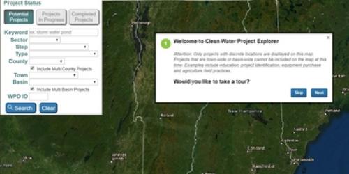
The central component of the Tactical Basin Plan is an implementation table summary with targeted actions to protect high-quality waters and to address the water quality issues in the watershed. Individual projects are included in the VT Watershed Projects Database (WPD).
The Northern Lake Champlain Direct Drainages includes the northern section of Lake Champlain, beginning just south of the Ferrisburgh and Charlotte town-line and ending at the Canadian border, and all Vermont surface waters in the drainage, except the three major river watersheds that drain directly into this section of the Lake. The Agency of Natural Resources has completed separate basin plans for those three major river watersheds, the Lamoille, the Winooski and the Missisquoi.
Older plans can be found at the following links:
Basin Specific Reports
- Biological and Aquatic Life Use Attainment Assessment of Allen Brook
- Aquatic Life Support Assessment of Englesby Brook
- Biological and Aquatic Life Use Attainment Assessment Potash Brook
- Biological Use Support Attainment Of the Rock River
- Existing Uses and Warm Water Fisheries in the North Lake Basin
- Aquatic Biota Impairment of Holmes Creek
- Aquatic Biota Impairment of Mud Hollow Brook