Oil and Gas
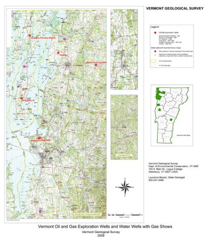
Six exploration wells shown on the map were drilled in Vermont between 1957 and 1984. However, there are no producing oil or gas wells in Vermont. Click on the well name in the table below for more information.
| Well Name | Town/County | Year | Depth (feet) | Drilling Company |
|---|---|---|---|---|
| Yandow #1 (pictures) |
St. Albans/Franklin County | 1957 | 4500 | Maquam Oil & Gas Development Corp. & Henderson Oil |
| Gregoire #1 | Colchester/Chittenden County | 1959-1960 | 5075 | Vermont Gas & Mineral Corp. |
| Gregoire #2 (Hazelett #1) | Colchester/Chittenden County | 1960-1961 | 2306 | Vermont Gas & Mineral Corp. |
| Alburg #1 | Alburg/Grand Isle County | 1964 | 5120 | American petrofina & Falcon Seaboard Drilling Co. |
| E.S. Baker | Grand Isle/Grand Isle County | 1968 | 3500 | Cambrian Corp. |
| Burnor #1 | Fairfield/Franklin County | 1984 | 6968 | Columbia Gas Transission Co. & Delat Drilling |
Links:
Vermont Statutes, Title 29: Natural Gas and Oil Conservation
Shale Plays in the US from the US Energy Information Administration
USGS National Oil and Gas Assessment
Northern VT-Southern Quebec: Utica shale equivalents, stratigraphic and structural relations (presentation by Becker et al., 2009)

