The Vermont Geological Survey provides reliable, science-based information about frequency, magnitude, extent, and consequences of physical hazards, and when possible, hazard avoidance strategies. To address potential risks, the Division conducts local and regional hazard assessments such as the Landslide Hazard Mapping project. By identifying regions sensitive to physical hazards and utilizing a scientific assessment to characterize the risks, the Division provides a tool to protect Vermonters in vulnerable areas. Information developed for landslides, earthquakes, flood and drought contributes to mitigation and preparedness for these low frequency, high impact events. See a listing of our hazard reports and presentations and the statewide landslide inventory GIS data.
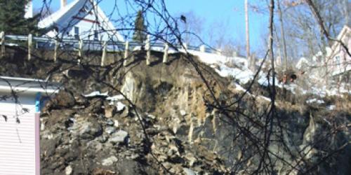
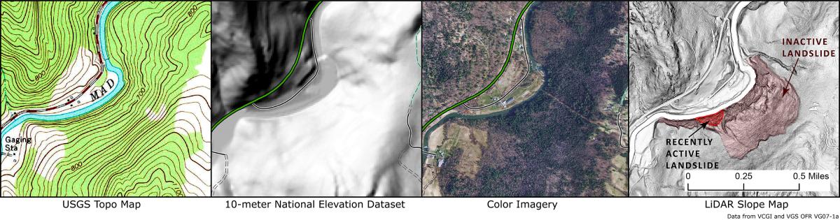
As an early geologic responder to landslides, qualitative assessments are made of the likelihood of continued slope failure and risk to Vermonters. The Geological Survey works with Regional Planning Commissions, VEMHS, and towns to implement the landslide hazard mapping protocol and planning. Report a Landslide is a new online feature in which the public can add to our landslide inventory. We also use LiDAR data (available through VCGI) to identify possible areas of concern and map active and inactive landslides.
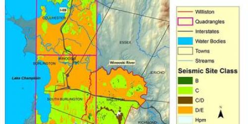
 Geologic hazards such as earthquakes and floods are part of the Geologic Hazards Program. Since 1997 the Vermont Geological Survey has partnered with VEMHS, UVM, FEMA, Norwich University, NESEC and others to conduct studies and outreach which serve to inform Vermonters and assist with emergency preparedness. Emergency preparedness, particularly of critical facilities, is informed through these studies. Mapping of surficial materials identifies areas of unconsolidated materials which may amplify shaking during a seismic event.
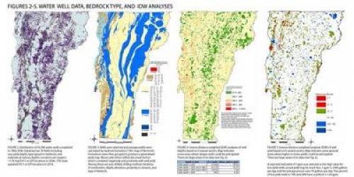
Regional groundwater studies provide data for drought resiliency and response. Geochemical and mineral-related hazards such as arsenic and radionuclides are addressed in the Geology and Health Program. FEMA has a number of mitigation ideas and strategies (2013) for communities to implement and a special comprehensive book: Safer, Stronger Smarter: A Guide to Improving School Natural Hazard Safety (2017). The USGS has a helpful landslide preparedness list.