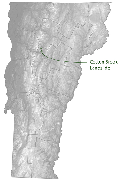
The Geology Division and the Department of Forest, Parks and Recreation are working to map and assess a large landslide in the Cotton Brook drainage of the Mount Mansfield State Forest in Waterbury. The landslide occurred on May 30 or 31, 2019. The main, active landslide area encompasses approximately 12 acres but cracks and scarps in the woods indicate that there are many other detached blocks (additional 2.2 acres). There is a high potential for additional failure, the site is dangerous and trails have been impacted. The landslide area increased by more than 10% in the days following the initial landslide. Given the nature of the underlying surficial deposits, additional slope failures at the site are likely, which could bring down large blocks of trees and soil, potentially causing additional blockage of Cotton Brook.
The landslide resulted in massive sedimentation in Cotton Brook, from the landslide location to the mouth of the brook at the west shore of the Waterbury Reservoir. Geologists from the Geology Division in DEC, Norwich University, and the University of Vermont are continuing to work and research the character of the landslide, the materials and landforms involved, and assess potential causes.
View slide presentation from 7/9/19. Updated presentation, January 2020
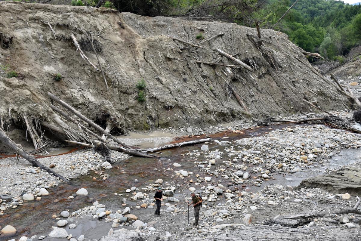
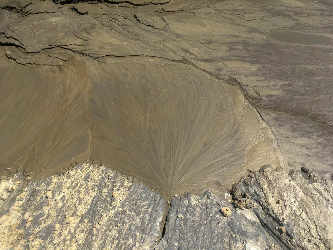
The slope of the landslide surface is approximately 28 degrees and the materials are predominantly fine-grained, lake-bottom silt and sand deposited in Glacial Lake Winooski. A slide surface of very fine silt to clay is visible and has been grooved and striated by the overriding material. The landslide toe extends across Cotton Brook and temporarily blocked stream flow. The brook eroded though the landslide material, but prior to the "Halloween storm" that occured on 10/31/2019, there was an area (approximately 2 acres in size) of impounded water upstream of the landslide. After the large rainfall event on 10/31/2019, a significant amount of large woody debris and toe deposits were washed downstream. As of July, 2020, no ponding was observed upstream of the landslide.
Vermont Geological Survey OFR VG2018-4 Surficial Geology and Hydrogeology of the Bolton Mountain Quadrangle, Vermont (Report, Geologic Map) describes the glacial history and surficial geology of the area.
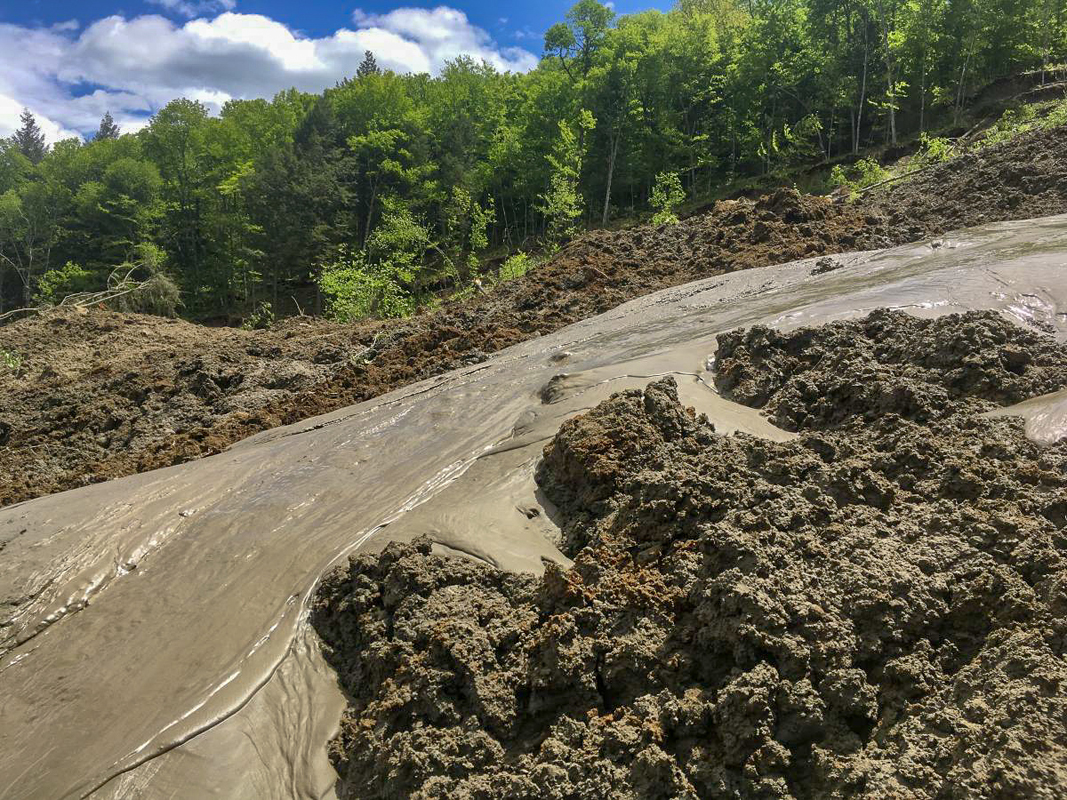
On Wednesday June 12th, the VT Agency of Transportation (VTRANS), the Dept. of Forest, Parks, and Recreation, and the Geology Division visited the site for additional landslide characterization work and to perform a UAS (Unmanned Aircraft System or drone) survey. The initial images provide a great perspective on the size and character of the landslide. Clip 1: Flight from the Cotton Brook channel to the head scarp at the top of the landslide. Clip 2: View of an active mudflow on the landslide surface comprised of glacial lake sand and clay, cobbles and small boulders.The Vermont Center for Geographic Information produced a web map to display the seamless imagery collected by the VTRANS UAS Program of the landslide and the mouth of Cotton Brook. Click here to report a landslide in other areas of the state.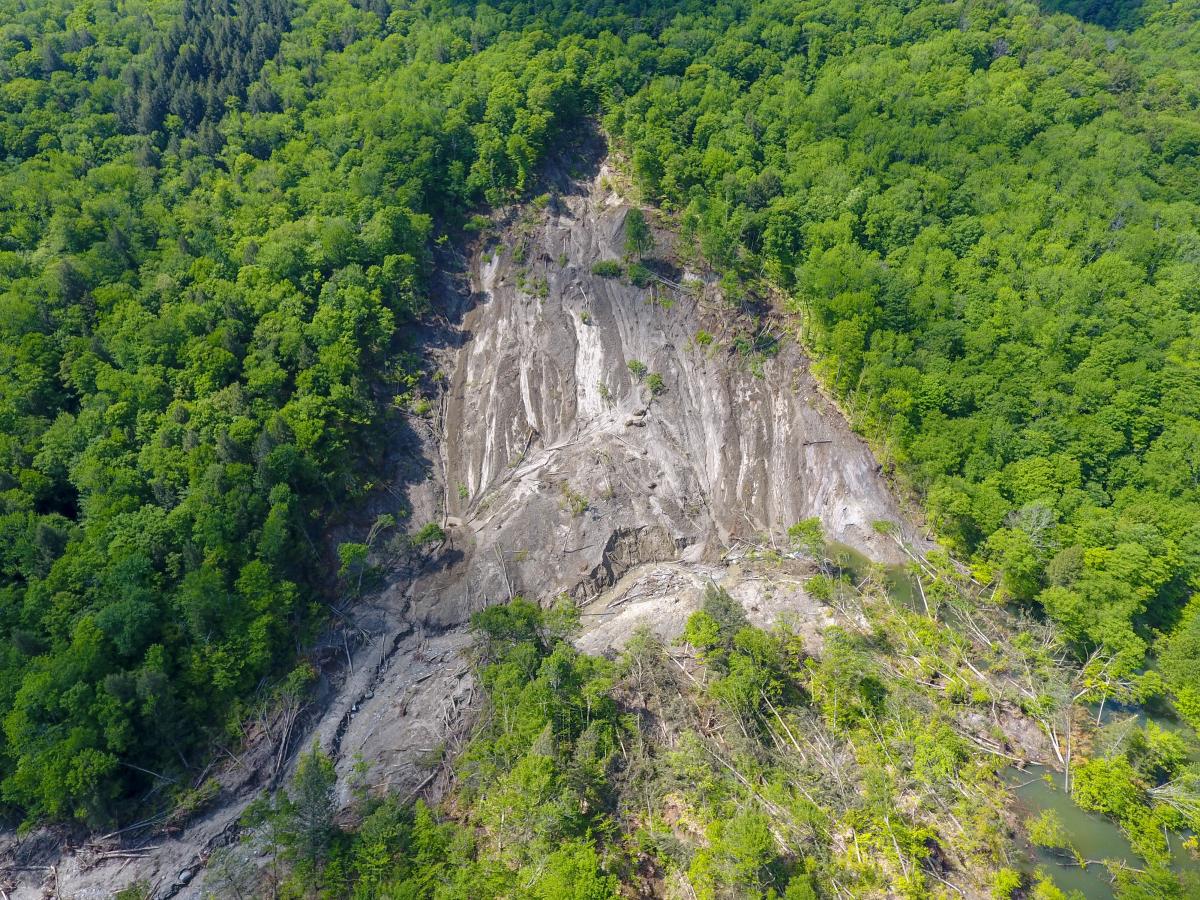
(Image of the Cotton Brook landslide from the VTRANS UAS Program, vantage to the south.)
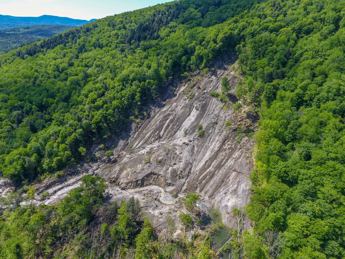
(Image of the Cotton Brook landslide from the VTRANS UAS Program, vantage to the southeast.)
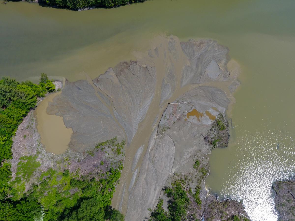
(Image of the mouth of Cotton Brook from the VTRANS UAS Program. North is to the left side of the image.)
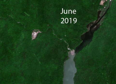
The extent of the landslide and the immediately impacted area extends at least 380 meters along the long axis of the landslide and at least 230 meters across. The Sentinel 2 LA-2 satellite collected imagery of the area on June 17th, as shown in the map below (Thanks to David Fox of VCGI). The imagery shows the landslide, Cotton Brook's new path through the landslide toe, and sediment from the landslide moving downstream. The extent of the impacted land extends beyond the visible edge of disturbed material as large blocks of material dropped down along the landslide edge with minimal horizontal displacement.
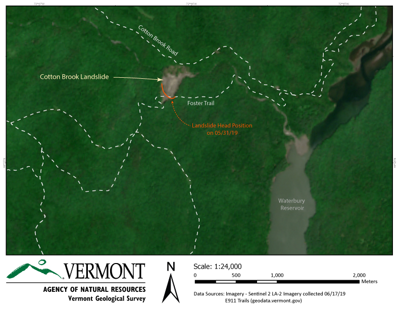
(Above: A map of the area with imagery from the Sentinel 2 LA-2 satellite on 6/17/19 and trails in the area, click to enlarge)
July 2020 Landslide Update
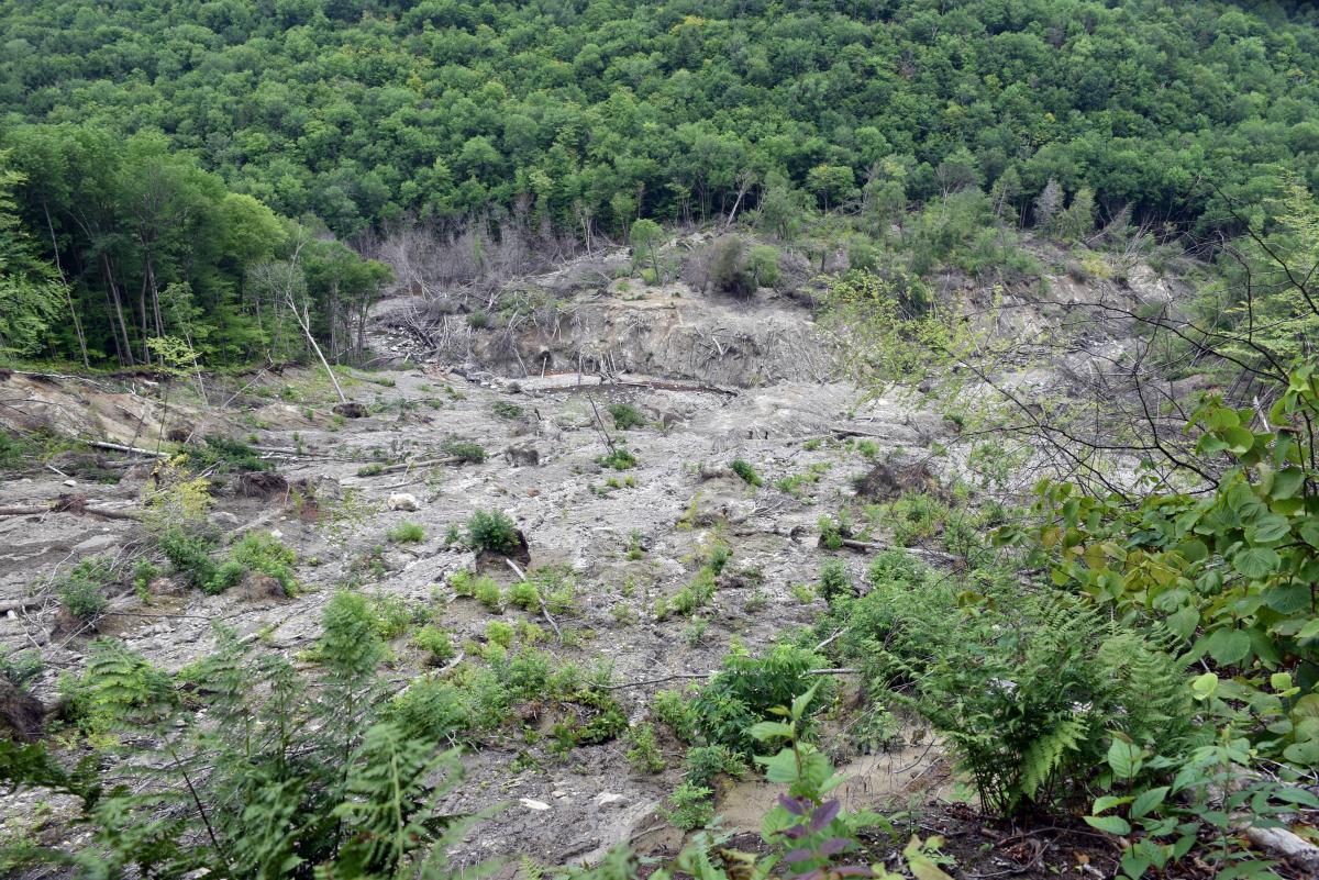
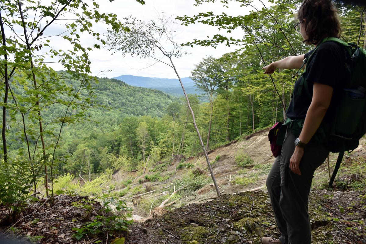
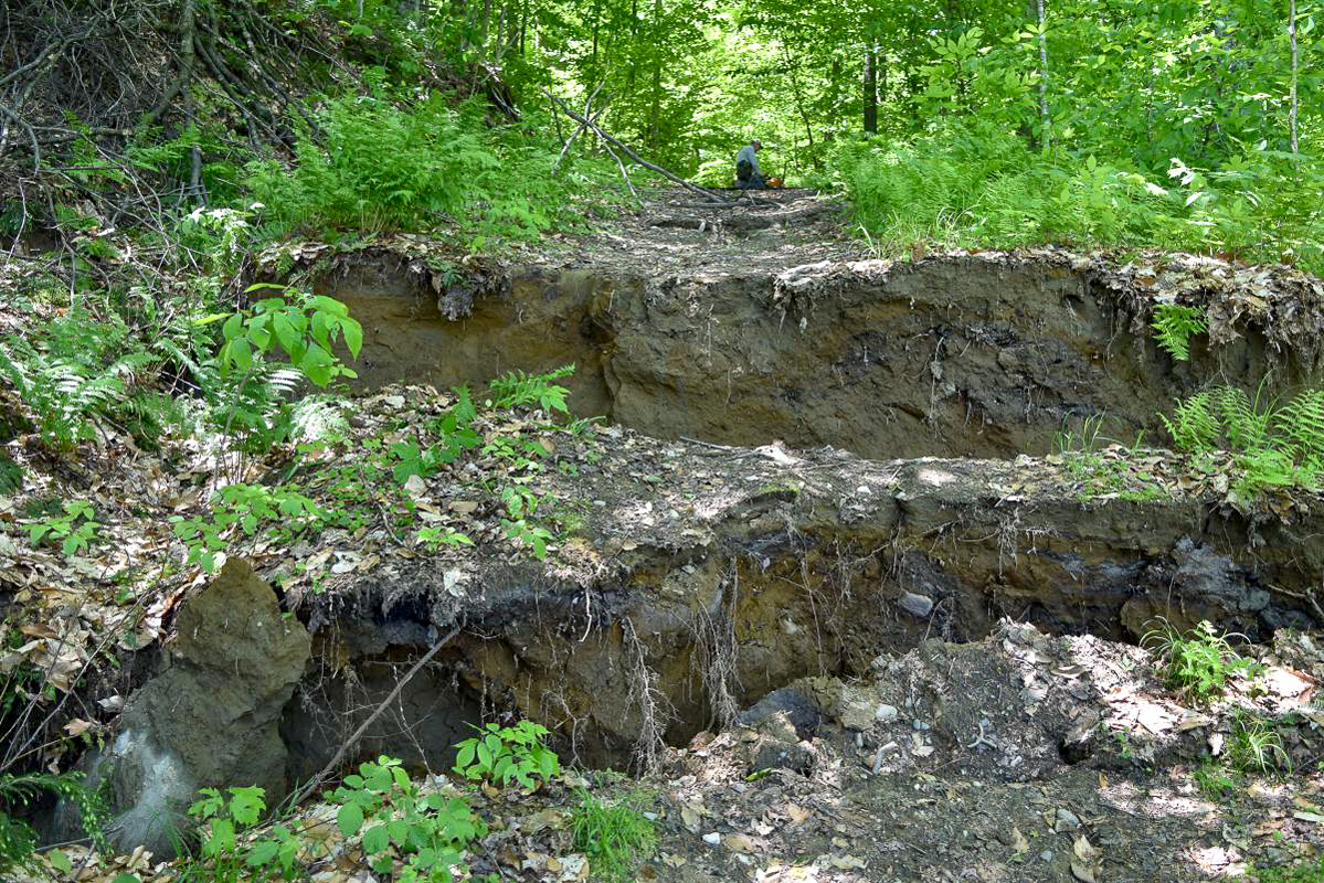
The Cotton Brook Landslide remains an active and potentially hazardous site. Vermont Geological Survey, Norwich University and Forest Parks and Recreation staff visited the slide in July 2020 to survey the site and retrieve camera footage collected over the winter. New GPS measurements and image analysis show that the landslide continues to expand both vertically and laterally along its rim. Several fresh slump blocks were observed at the head of the landslide and multiple tension cracks and additional scarps were seen along the eastern and western flanks. The two edges of Foster’s Trail, separated by the initial landslide in 2019, have continued to lose material and step back from their former borders. A future blockage of Cotton Brook due to additional slope failures is possible, but there is no longer concern that material has the capacity to reach Cotton Brook Road.
The initial trigger for the landslide in May of 2019 is still unknown. Following a closer examination of geologic materials on the landslide surface and newly exposed materials just beneath the surface in Cotton Brook, we hypothesize that the 2019 landslide may have formed on glacial lake bottom deposits of very fine sand, silt and silty clay that had previously failed in an older, possibly subaqueous landslide in Glacial Lake Winooski. For more information about Vermont’s glacial lake history, please see our page here.
The VGS and partners will continue to monitor the site for potential changes. Work may include additional drone flights and/or high-precision GPS field mapping to better define the expanded landslide boundaries, and a seismic refraction survey to delineate the bedrock surface that underlies the glacial material.
-Julia Boyles (1), George Springston (2) and Jon Kim (1)
(1) Vermont Geological Survey and (2) Norwich University Department of Geology and Environmental Science
July 24th, 2020
(Above: Satellite photos comparing the landslide area (center-left) from June, 2019 to June, 2020)
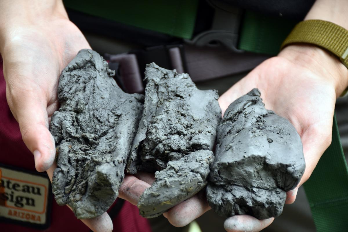
(Image of a sample of hand augered glacial lake clay deposits. These clays compose the slide surface. Photo: J. Kim, 07/2020.)
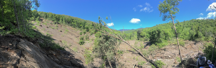
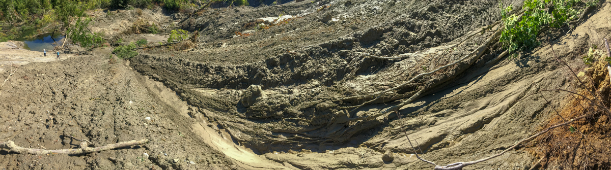
(Above: A panoramic image of the landslide area from the eastern flank. Cotton Brook is located in the bottom right corner of the image)
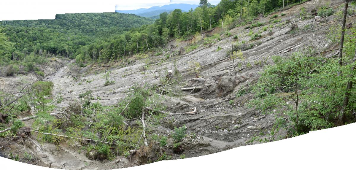
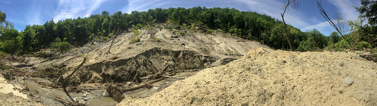
(Above: A panoramic image of the landslide surface from the western flank. Cotton Brook is located toward the top left of the image. Photo: J. Kim, 07/2020)
Additional Photos
July 2020: